Niseko Side 6

Niseko Side 6

Niseko Side 6 (Нисеко,Япония)

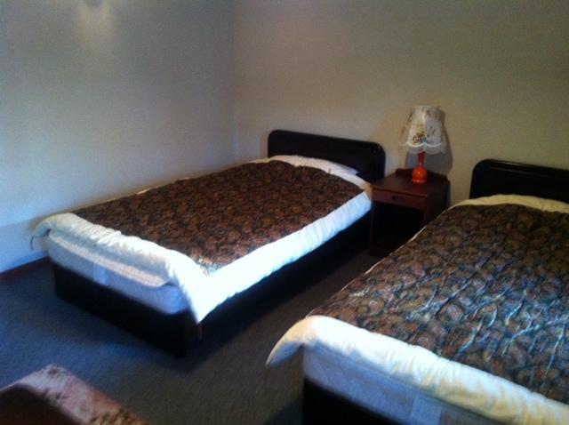
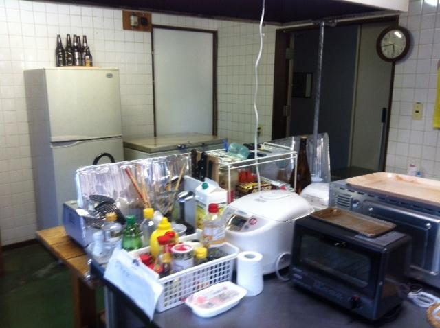
Категория отеля: 1-звездочный отель
Адрес: 048-1511 Хоккайдо, Нисеко, Aza Niseko 482-1, Япония
Описание: Only a 2-minute drive from Niseko Annupuri Ski Resort, Niseko Side 6 offers beds in dormitory rooms, as well as private rooms. The hotel features free-use washing machines, a shared kitchen and a living room with a flat-screen TV, a CD player and free Wi-Fi.Dormitory rooms feature 2 robust bunk beds for 4 people and a table, while private rooms have twin beds. Bathroom facilities are shared and accessible 24 hours.Guests can go skiing in the area, and relax in the living room while watching TV, browsing through comic books or using the PC. They can unwind in a soothing hot bath, which is accessible at different times for men and women.Niseko Side 6 is a 13-minute drive from Niseko Milk Kobo, which features delicious pastries, puddings and other fresh products from dairy. Fukidashi Koen Park is a 1-hour drive away.
Еда и питье:
На свежем воздухе:
Парковка: Бесплатно! Бесплатная Частная парковка на месте (предварительный заказ не требуется) .
Услуги: Отопление
Спорт и отдых: Катание на лыжах
Сервис: Прачечная
Интернет: Бесплатно! Wi-Fi предоставляется в общественных зонах бесплатно.
Языки общения:
Время заезда/выезда: C 12:00 / До 18:00
Домашние животные: Размещение домашних животных не допускается.
Банковские карты:
Номерной фонд: Хостел: 2 номера
Координаты: ш. 42.846300019309844 д. 140.6447920203209 на карте
 

Каталог отелей.

Игры ⚽ Поможем решить контрольную работу

Полезное


Смотреть что такое "Niseko Side 6" в других словарях:

  • The Vale Niseko — Infobox Skyscraper building name = The Vale Niseko year highest = year end = plural = location = Hirafu Village, Niseko, Hokkaidō, Japan status = Under Construction groundbreaking = June 2008 constructed = est completion = December 2009 opening …   Wikipedia

  • Kutchan, Hokkaidō — Infobox City Japan Name= Kutchan JapaneseName= 倶知安町 Map Region= Hokkaidō Prefecture= Hokkaidō (Shiribeshi) District= Abuta Area km2= 261.24 PopDate= March,2008 Population= 15,369 Density km2= Coords= LatitudeDegrees= 42 LatitudeMinutes= 54… …   Wikipedia

  • Sapporo Station — 札幌駅 South side of the Sapporo Station Location Prefecture …   Wikipedia

  • Chichibu Tama Kai National Park — 秩父多摩甲斐国立公園 IUCN Category II (National Park) …   Wikipedia

  • Ukichiro Nakaya — Infobox Scientist name = Ukichiro Nakaya image width = caption = birth date = July 41900 birth place = Kaga, Ishikawa death date = April 111962 death place = ethnicity = Japanese field = Physics work institutions = alma mater = University of… …   Wikipedia

  • Snow — Snowfall redirects here. For other uses, see Snow (disambiguation) or Snowfall (disambiguation). Snow is a type of precipitation in the form of crystalline water ice, consisting of a multitude of snowflakes that fall from clouds. The process of… …   Wikipedia

  • Type 89 I-Go — Infobox Weapon name=Type 89 I Go (Chi Ro) caption=A restored Type 89 I Go at Tsuchiura GSDF Base open day origin=flag|Empire of Japan is vehicle=yes length=convert|5.73|m|ftin|abbr=on width=convert|2.13|m|ftin|abbr=on… …   Wikipedia


Поделиться ссылкой на выделенное

Прямая ссылка:
Нажмите правой клавишей мыши и выберите «Копировать ссылку»